Road Gradient and Superelevation analysis with CATS-INS
One application I have been looking at recently is using the CATS-INS to survey roads, in terms of measuring the gradient and superelevation. This is being used to check the maximum safe speeds on roads according to road angle and turn radius. I’ve attached a couple of screenshots below to show the kind of data which can be achieved.
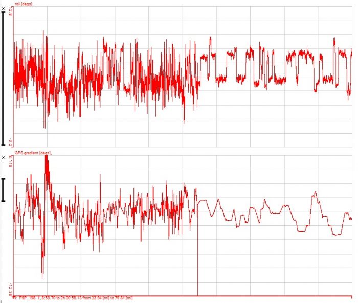
This shows roll and gradient against distance, the first half of the run was on an old cross country road, the second part on a modern motorway.
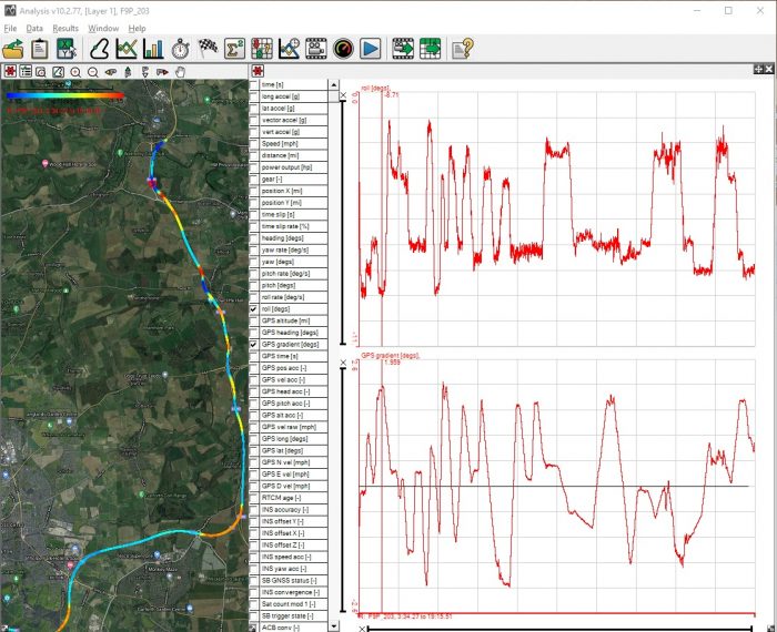
Another section on a motorway clearly shows the superelevation used on the bends and how carefully the gradient of the road is controlled. No abrupt changes in gradient and gradient limited to 2 degrees.
The roof unit wasn’t zeroed before these measurements were taken, so there is an offset on the roll measurements in the data. Taking the measurements simply involves driving along the road at normal speeds, nothing special required at all and the quality of the data is superb.
Per maggiori informazioni contattaci:
https://www.lunitek.it/contatta-sensoristica-e-acquisizione-dati/


